2023 Erosion and Sediment Control Field School
Wednesday, June 7, 2023 to Thursday, June 8, 2023
Salmonid Restoration Federation hosted an Erosion and Sediment Control Field School June 7 - 8, 2023 on the Medocino Coast. This technical field course was part of our Northern California Best Management Practices Education Series funded by the California Department of Fish and Wildlife’s Fisheries Restoration Grant Program. SRF partnered with Pacific Watershed Associates to offer a technical workshop and field tour curriculum in Mendocino County. The agenda was designed to assist planners, regulators, environmental scientists, engineers, and landowners to improve environmental protection by identifying, assessing, and ultimately designing erosion control projects. The field school will included topics such as:
-
Identifying sediment sources and quantifying erosion volumes
-
Evaluating sediment sources for their potential to deliver sediment to streams
-
Assessing environmental impacts from accelerated erosion and sediment delivery
-
Creating erosion control and prevention plans
-
Identifying high priority erosion and sediment control activities on post wildfire landscapes
-
Assessing, prioritizing and estimating costs of post wildfire road treatments
-
Designing, procuring and evaluating grading plans and permits
-
Environmental permitting application process and requirements
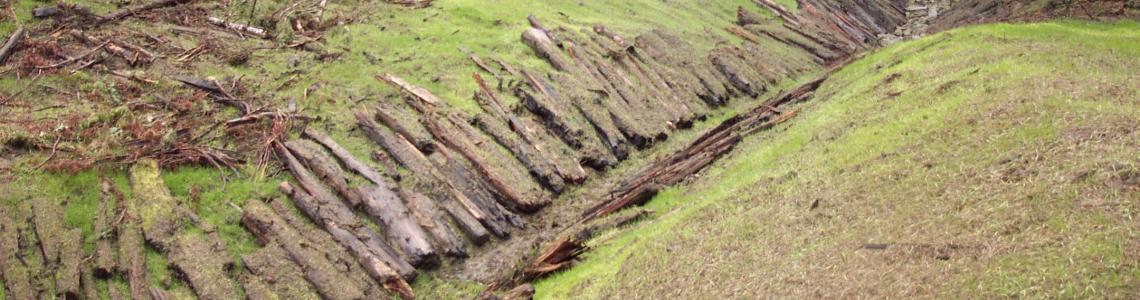
The primary field component of the roads training occurred on property managed by the Redwood Forest Foundation Inc. (RFFI) in northern Mendocino County. Tour sites included recently upgraded roads that exemplify significant road drainage improvements with stream crossings that presented interesting and unique challenges. Additionally, the field trip explored recently decommissioned roads, their associated stream crossings, and large wood loading in the adjacent stream channel to enhance environmental conditions. The tour also looked at recent road upgrades that included conversion from an insloped road to an outsloped road with stream crossings reconstructed as armored fills. Lastly, there was a review of techniques to identify, characterize and treat road related sediment sources which can be used to create prioritized action plans for wildland road systems.
See the Resources tab for PDFs and guides.


Mendocino
, CA
See map: Google Maps